
Written by Pam Knox, UGA Agricultural Climatologist, and taken from the CASE website
February 2015 was the second coldest February since 1978, based on preliminary data from National Weather Service stations, rivaling the chilly February of 2010. Precipitation was variable across the state, although most stations were close to normal. Two major storms caused significant impacts across northern Georgia in mid- and late February.
Temperatures across the state were well below normal in February. In Atlanta, the monthly average temperature was 40.4 degrees F (6.8 degrees below normal), in Athens 40.3 degrees (6.9 degrees below normal), Columbus 44.7 (6.4 degrees below normal), Macon 43.7 (6.3 below normal), Savannah 47.3 (5.7 below normal), Brunswick 49.2 (5.3 below normal), Alma 47.7 (6.5 below normal), Augusta 42.8 (6.3 below normal), Albany 47.7 (4.7 below normal) and Valdosta 49.5 (4.7 below normal).
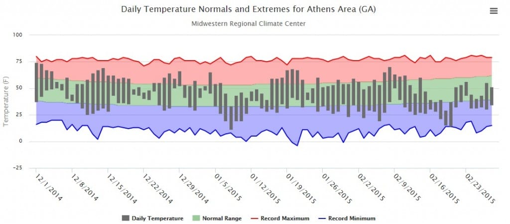
A number of daily low temperatures were broken this month, most during a cold outbreak February 19-21. On February 20, Athens set a record low of 14 F, smashing the old record of 18 F set in 1958. Columbus recorded 21 F and Macon 18 F, beating the old records of 22 F and 21 F, both also set in 1958. Savannah set both a record low minimum and maximum temperature on that date, reporting a high of 41 F, which broke the record of 44 F, and a low of 21, breaking the old record of 22 F set in 1958. Alma and Brunswick set record low maximum temperatures on both the 19thand 20th and Augusta set a record low maximum temperature on the 19th.
The thermograph below (produced using cli-MATE from the Midwestern Regional Climate Center) shows the daily temperature observations for Athens for the last three months to show how much below average this cold outbreak was.
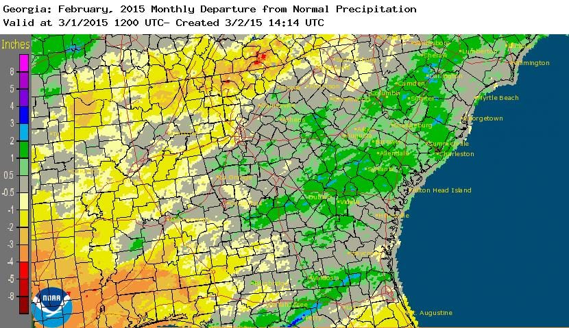
The highest monthly total precipitation from National Weather Service reporting stations was 4.70 inches in Augusta (0.28 inches above normal) and the lowest was in Brunswick at 2.69 inches (0.78 inches below normal). Atlanta received 4.15 inches (0.52 inches below normal), Athens received 3.99 inches (0.49 below normal), Macon received 4.36 inches (0.0 below normal), Columbus 4.22 inches (0.22 below normal), Savannah 3.44 inches (0.65 above normal), Alma 3.62 inches (0.18 below normal), Valdosta 4.60 inches (0.44 above normal), and Albany 4.03 inches (0.13 below normal).
Atlanta and Athens reported daily precipitation records for traces of snow on days which had never experienced snow before: Atlanta reported snow on the 21st, and Athens on the 19th and 20th.
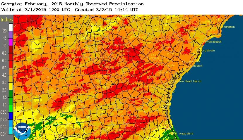
The highest single-day rainfall from CoCoRaHS stations was 3.20 inches in Eastman in Dodge County on February 26, followed by 2.95 inches received southeast of Sylvania in Screven County on the same date. The highest monthly total rainfall was 6.52 inches, observed south of Americus in Sumter County, followed by 6.31 inches south of Senoia in Coweta County. The highest daily snowfall value was 8.2 inches reported near Rabun Gap on the 26th, and they also had the highest monthly snowfall total of 12.1 inches.
Two winter storms caused problems in northern Georgia this month. On February 16-17 a storm brought freezing rain, sleet and snow to areas of the northeast, dropping many tree limbs and cutting power to many. At the height of the storm almost 100,000 people in Georgia were without power. Many schools closed due to hazardous weather as well as lack of power.
A second major winter storm caused problems across northern Georgia in late February. The storm was part of a large weather system which brought mixed winter precipitation to areas from Texas to Washington DC. You can read a detailed write-up of the storm from the Peachtree City National Weather Service office athttp://www.srh.noaa.gov/ffc/?n=20150225_heavy_snow.

Because of the cold weather this month, no severe weather was reported anywhere in the state in February.
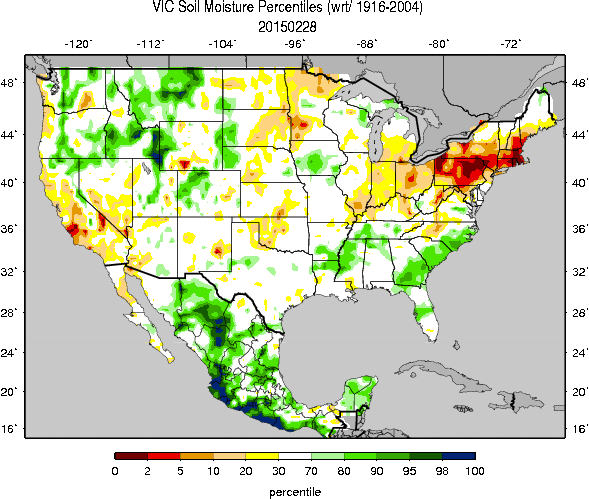
The above normal precipitation in south Georgia increased soil moisture, helping to eliminate abnormally dry conditions in some areas. The driest part of the state is now in the far north.
The cold temperatures caused frost damage to early blueberries in south Georgia. Estimates of losses ranged for 10-15 percent in areas where frost protection was used to 30-40 percent in areas where it was not. This is expected to delay the delivery of early Georgia blueberries to markets for one to two weeks. Small grains have also continued to suffer from the cold conditions.
The outlook for March shows wet and cold conditions may continue into the first half of March. By mid-month, a major pattern shift is expected to bring much warmer air into the Southeast.