Taken from the CASE website
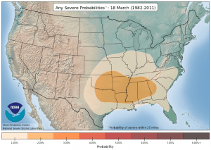
Now that spring is here and warmer, more humid air is entering the US, severe weather and tornado chances are increasing across the country. There is an excellent animation that shows how the region of severe weather occurrence moves around the country at the NOAA Storm Prediction Center. The area of most likely severe weather moves north and south with the area of greatest temperature contrast and most active storm track as the sun’s angle changes over time.
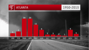
The Weather Channel has also provided a series of bar graphs which show the monthly probability of tornadoes for over 40 cities around the country (link). From the graphs you can see that the Southeast has a split severe weather season, with the major peak in spring and a secondary peak in late fall.
For answers to every question you can ask about tornadoes, check out the tornado FAQ from the Storm Prediction Center.
And make sure you have access to real-time severe weather warnings via smartphone app or NOAA weather radio, especially if you are working outside on high-risk days.


